We continued driving north along the west coast of the Shimokita Peninsula. As you can see it's a windy drive through the mountains. We made our way to Hotokegaura with one short stop along the way. The distance on this map from the bottom point to the top point is about 36km (22mi). It took us right at an hour.
Scenic overlook, too bad it was so overcast
unique bathroom
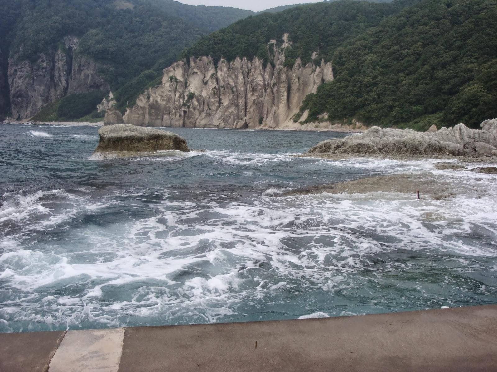
Arriving at Hotokegaura which I've found means "the coast of the Buddha". I assumed that we would be parking right close to these rock formations, but the parking lot was actually a little hike (about a mile I think) away from the coastline. The way there was all downhill, they'd made a gravel path then wooden steps and boardwalks.
This sign greeted us at the start of the path!
The Hotokegaura coast is about 2km in length and was named because the rocks were said to look like statues of Buddha (we didn't really see it, maybe our imaginations weren't working today). The rocks were carved naturally by wind and water erosion. I believe most of the rock formations also have names, but I don't know what they are. Disappointed that it was an overcast day, but still so beautiful!
I'm pretty tiny next to those rocks!
Found a climbing opportunity!
This is what the rock looked like, sparkly gray and white with aqua crystals
This looked like a hawk
And then we had to walk back to the car...
all uphill going back. Just because it was overcast
did not mean it wasn't a hot day! Glad I packed
Keenan a fresh shirt and some towels!
With the A/C on high we continued driving north and look what we saw! Japanese Macaques! Snow Monkeys! We saw one swinging on some branches on the left side of the road so we stopped, but then it was gone :( Just as we started to drive again Keenan looked in the rear view mirror and noticed one on the right side up on a retaining wall. We stopped again and from then on they just kept coming, a whole troop of them! So awesome! These are the most northern living monkeys in the world.
This one had a baby on her back!
Mom and baby
We shot a short video of the monkeys, you can watch it below, I removed the sound so you couldn't hear the dumb things we were saying ;)
View from above.
I'm sure this sign discusses the dangers of the monkeys,
not to feed them, touch them, etc.
We had to drive the rest of the way to Oma hoping we would get there before dark. Cape Oma is the most northern point of Honshu Island. On a clear day we would have been able to see the island to the north, Hakkaido, definitely not today!
We made one quick stop near a park, Saimura Gankake Park, Sai was the name of the village and the rest translates to something like "Buddhist Prayer Park." The rocks above my head are "man Buddhist prayer" and "Buddhist prayer woman". The rocks are said to be a place to pray for the "fulfillment of marriage and the true marriage dedication". Or at least that's what I get out of one translation I found...
Signs warning us everywhere, but haven't seen any.
We made it to Oma before dark, barely. Here's the view north from Cape Oma. They are famous for the tuna caught here. It's supposedly the best tuna in the world. ONE bluefin tuna caught here broke a record in 2013 by selling for $1.8 million at the fish market auction in Tokyo. It weighed 222kg.
Not sure where these steps lead to...
a ferry landing spot maybe?
Can see a lighthouse, but not much else.
This was below the tuna statue, I don't know the significance
of the "400kg" maybe the largest tuna caught here?
"This is the northernmost point of Honshu"
Up next: I find some interesting things on the beach...


No comments:
Post a Comment